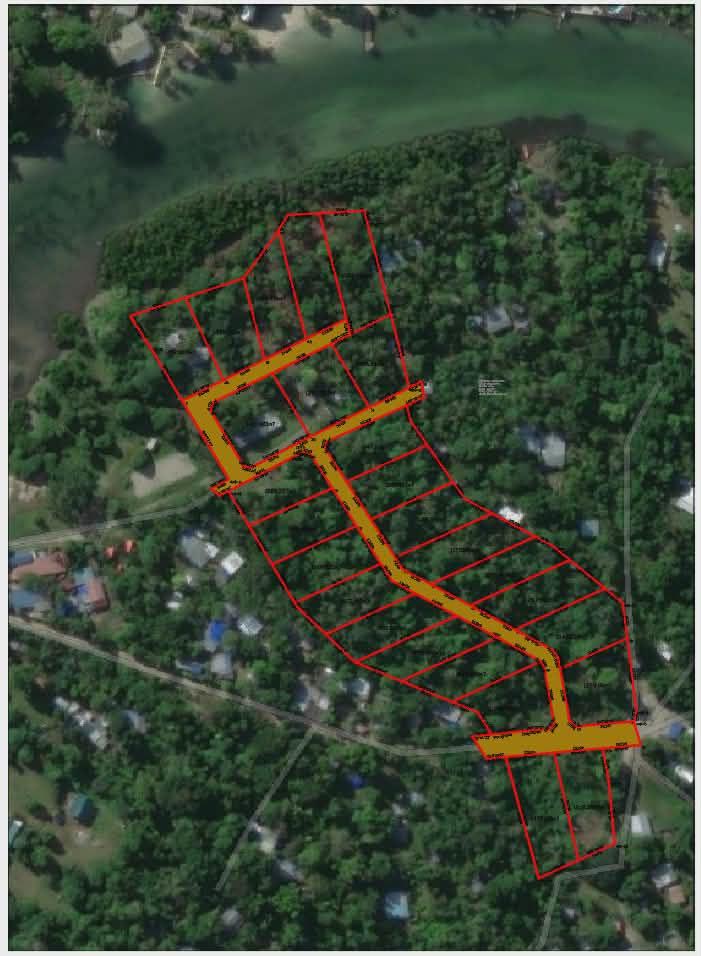


An incredibly lifelike, richly detailed, photorealistic aerial photograph of a coastal residential development project set in a lush, tropical environment. The scene is illuminated by bright, overhead sunlight, creating sharp shadows and highlighting the vibrant greens of the dense foliage and the deep blue of the adjacent body of water, imparting a clear, daytime atmosphere. Captured with a high-resolution satellite camera, emphasizing the intricate details of property lines, a winding dirt road network, and scattered houses nestled amongst the trees. The composition shows a series of parcels delineated by thin red lines, with internal roads marked in a distinct shade of yellow, suggesting a planned development. The background features the shimmering, slightly textured surface of the sea or a large lake, with glimpses of small docks extending into the water. Buildings, varying in size and color, are visible throughout the landscape, hinting at an established community amidst the new development. The perspective is directly top-down, providing a comprehensive overview of the land division and its integration with the natural surroundings, with a sharp focus across the entire image, revealing the unique textures of the canopy, rooftops, and the unpaved roads.